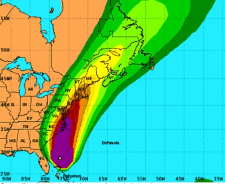
Via the National Hurricane Center, Irene is still tracking toward the outer banks of North Carolina and will likely affect eastern parts of the DC metro region, from Norfolk thru Baltimore. Depending on the precise track, the storm may remain over open water allowing it to remain a powerful tropical cyclone all the way to New Jersey.
Going forward, the eye will probably wobble and every little wiggle may produce a flurry of concern or guarded relief. But it looks like Irene will have an impact on the mid and upper US eastern seaboard no matter what deviations appear at this point. Via Dr. Rob Carver at WeatherUnderground:
To find out if you need to evacuate, please contact your local emergency management office. They will have the latest information. FEMA has information on preparing for hurricanes. FEMA also has a blog describing their response to Irene.
Perhaps the greatest threat to life and property will be the flooding from Irene’s storm surge and considerable rainfall. The NHC has created a Storm Surge Risk interactive map. It is strongly recommend all residents anywhere near the track take a moment and assess their individual risk.


Piers Morgan on CNN, about 30 seconds ago though perhaps delayed for the West Coast:
“Worst Case Scenario: Hurricane Irene is so big it can be seen from space!”
I’d guess pretty much any hurricane can be seen from space, if you happen to be there and are close enough to see features on the earth. Major media fail, as usual. Fox Noise no doubt figures it’s Obama’s fault.